Switchback
A hike planner that reads any GPX route, then tells you how long it will take, when to turn back, what to pack and how much daylight you'll have.
Screenshots
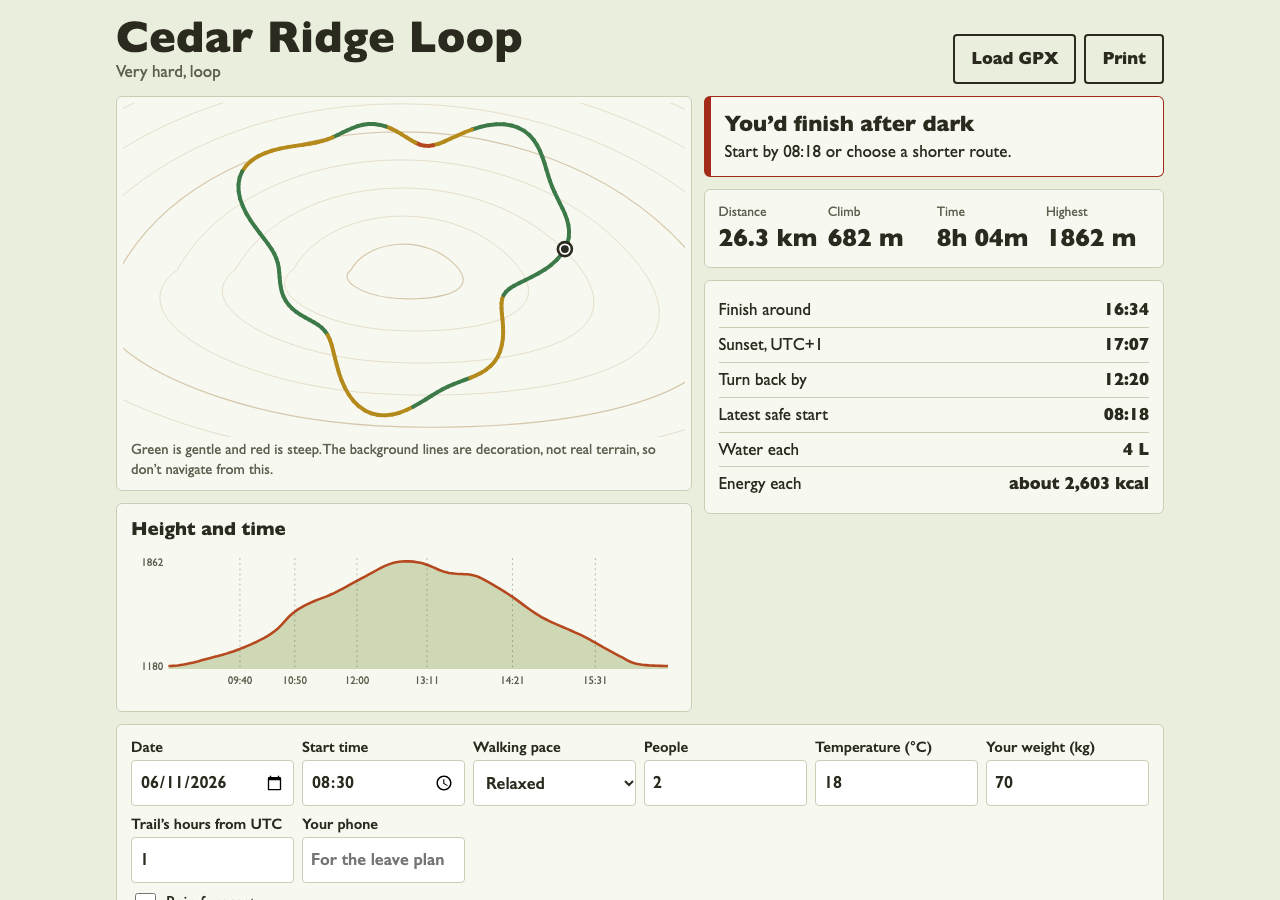
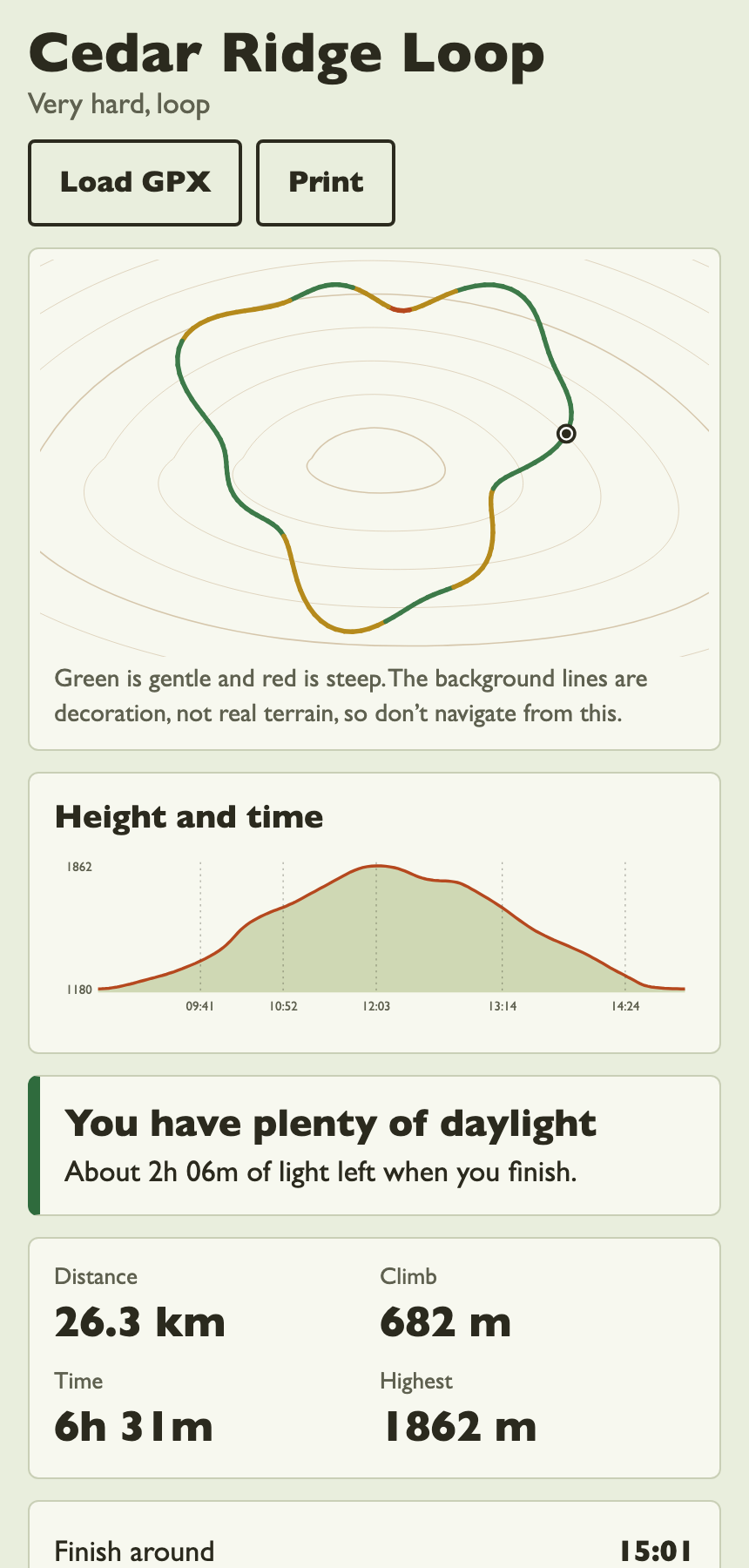
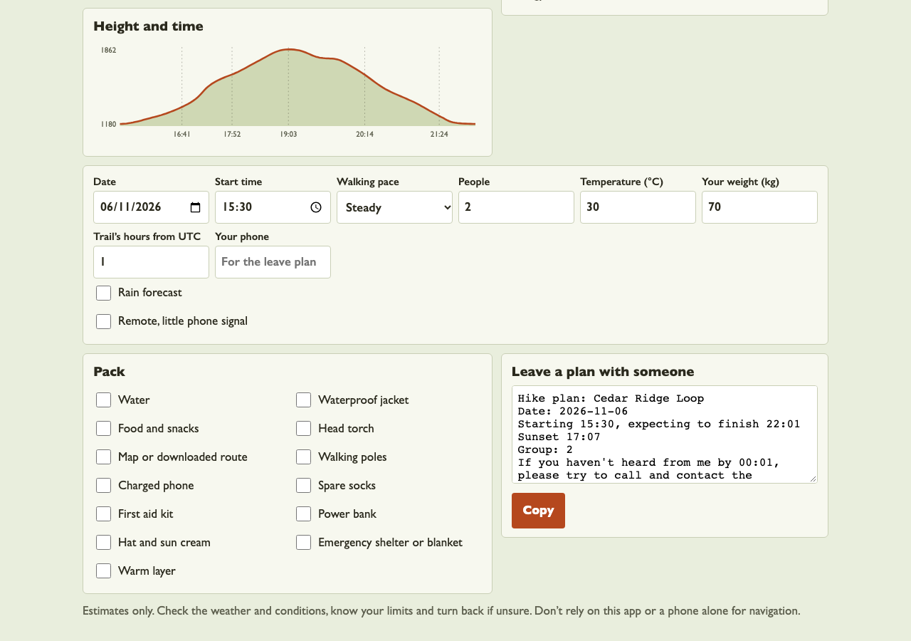
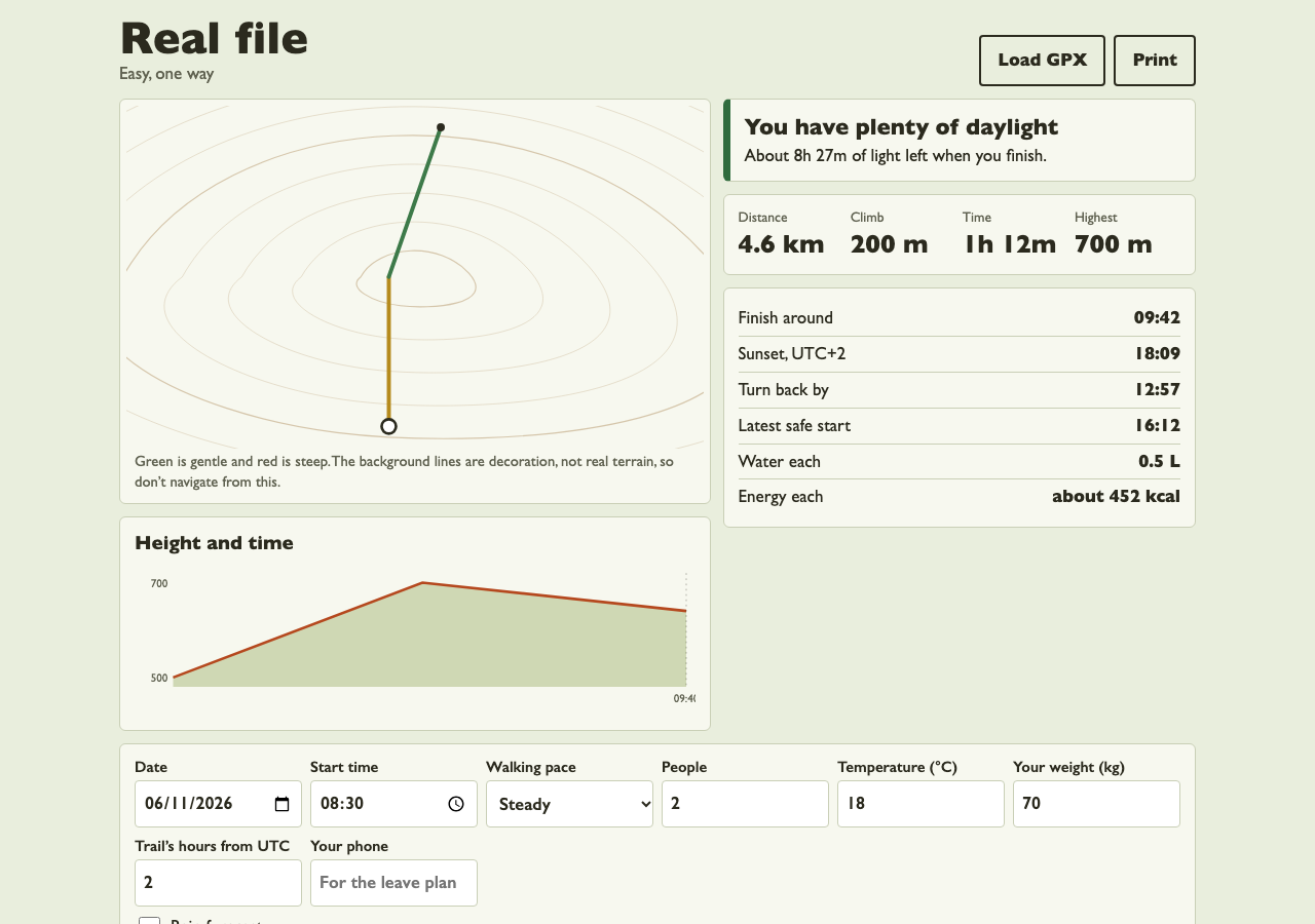
Screenshots supplied by the seller.
Description
Switchback answers the question that matters most on a day walk: will I get back before dark? Load a GPX file from any mapping app, choose your date and start time, and it builds a complete plan on one page.
It estimates time from every slope on the route using Tobler's hiking function, then adds breaks and adjusts for your pace and group size. Sunset is calculated for the trail's location and date. You get a finish time, a turn-back time and the latest safe start. If the plan runs too close to dark, it says so clearly.
The route is drawn coloured by steepness, next to a height profile marked with expected clock times. GPS jitter is filtered out so the climb figure stays realistic. Water and energy estimates follow the length of the walk and the temperature, and the packing list changes with conditions, adding a head torch when daylight is short or waterproofs when rain is forecast.
One tap copies a leave plan to send to someone at home, with when to expect you and when to raise the alarm. Everything runs in the browser, so routes never leave the device. It's plain JavaScript with no server or running costs, and it suits a walking club, guide, outdoor shop or tourism board.
Condition
Development stage: Working prototype (seller-declared)
Seller-declared: provided by the seller, not independently verified by SellMyVibe.
- Solo creator
- Mainly AI-generated
- Under one month in development
- Mobile-friendly
- Tests included
- Setup guide included
- Demo available
What works
- GPX import from tracks or routes, kept on the device
- Time estimates from Tobler's hiking function, with breaks, pace and group size
- Climb figures with GPS jitter filtered out
- Sunset for the trail's location and date
- Finish time, turn-back time and latest safe start
- Clear warnings when daylight is tight or too short
- Route shape coloured by steepness
- Height profile with expected clock times
- Water and energy estimates
- Packing list that follows the conditions
- Copyable leave plan for someone at home
- Printable plan
- An invented example trail
- 11 tests, including sunset times checked against published figures, plus an automated browser run
What’s unfinished
- No real map or navigation: the route shape sits on decorative lines and can't be used to find your way
- No live GPS tracking, weather forecast or offline mode
- You can't draw a route in the app, so a GPX file is needed
- The trail's time zone is entered by hand, and it doesn't work out daylight saving for a future date
- Terrain, weather and fitness aren't measured, so times are estimates
- English only, and it hasn't been tried on a real hike or a real phone
Included assets
Full source code
Test suite
Documentation
Technologies
HTML, CSS, JavaScript (ES modules), SVG, GPX, localStorage, Node test runner
Setup requirements
Upload the files to any static web host. To try it locally, run python3 -m http.server and open http://localhost:8000. Run the tests with npm test (Node 20 or newer).
Dependencies and ongoing costs
None. It's a static site that runs free on any web host, with no map service or API keys.
Known limitations
Switchback is a planning aid and not a navigation or safety device. Its figures are estimates that don't account for terrain, weather, injury or route conditions, and mountains can be dark earlier than sunset. Users must check conditions, carry proper navigation and turn back if unsure.
Listings are reviewed for completeness and clarity before publication. Approval is not a guarantee of quality, ownership, security or commercial success. Read the details and ask questions before buying.